Showing 15 items matching melbourne parks and waterways
-
 Greensborough Historical Society
Report, Melbourne Parks and Waterways, Happy Hollow Farm Complex : Conservation Strategy [excerpts], 1996_07
... melbourne parks and waterways. cultural heritage...This report was commissioned by the Melbourne Parks...Melbourne Parks and Waterways.... This report was commissioned by the Melbourne Parks and Waterways ...This report was commissioned by the Melbourne Parks and Waterways in 1996. It contains a history of the place and building, and garden and landscape features. There is a Statement of Cultural Heritage Significance. Happy Hollow was occupied (and probably built) by Emmett Whatmough in 1893, and owned by John Cully McLaughlin. There are other family connections among the Greensborough district pioneers.Copy of document, 16 pages plus maps.happy hollow, whatmough, bell, mclaughlin, melbourne parks and waterways. cultural heritage significance -
 Heidelberg Golf Club
Book, Melbourne Parks and Waterways, Lower Plenty River concept plan: Maroondah Pipe Track to Yarra River, 1994
... Melbourne Parks and Waterways...Melbourne Parks and Waterways... Lower Plenty River Heidelberg Golf Club MMBW Melbourne Parks ...Lower Plenty River concept plan: Maroondah Pipe Track to Yarra River. Includes suggestion of Plenty River Trail along the west boundary of the Heidelberg Golf Club.66 p., illus., colour map. Also, Draft copy of document.plenty river trail, lower plenty river, heidelberg golf club, mmbw, melbourne parks and waterways -
 Eltham District Historical Society Inc
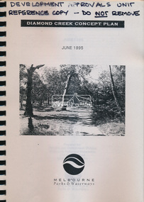
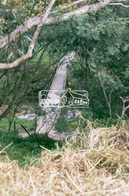
Book, Melbourne Parks & Waterways, Diamond Creek Concept Plan, June 1995
... Melbourne Parks & Waterways... plages plus appendices and fold out A3 maps Melbourne Parks ... -
Whitehorse Historical Society Inc.
Document, Open space between Yarran Dheran and Schwerkolt Cottage, 2001
... Report of an open space assessment by Melbourne Parks... by Melbourne Parks and Waterways land between Yarran Dheran ...Report of an open space assessment by Melbourne Parks and Waterways land between Yarran Dheran and Schwerkolt Cottage.Report of an open space assessment by Melbourne Parks and Waterways land between Yarran Dheran and Schwerkolt Cottage. Council Paper PROP/016781Report of an open space assessment by Melbourne Parks and Waterways land between Yarran Dheran and Schwerkolt Cottage. yarran dheran, nunawading and district historical society inc., schwerkolt cottage -
University of Melbourne, Burnley Campus Archives
Plan, Albert Park, c.1994
... Consultant Land Systems EBC, Melbourne Parks & Waterways. 1 copy... Boulevard Richmond melbourne Plan Albert Park Plans of sections ...Plans of sections of Albert Park by The Hassell Group, Lead Consultant Land Systems EBC, Melbourne Parks & Waterways. 1 copy laminated of each of: (1) 2 copies Albert Park Golf Course Proposal. (2) Ross Gregory Drive Precinct. (3) Lakeside Drive May 1994. (4) 2 copies New South Melbourne Soccer Ground. (5) 2 copies Aughtie Drive. (6) 2 copies Aughtie Drive Precinct. (7) 2 copies New Home for South Melbourne Cricket Club. (8) Final Proposed Strategy Plan: Realising the Vision, coloured, Key features of the plan on reverse. -
 Eltham District Historical Society Inc
Photograph, Fay Bridge, Former Glynn's Dairy Farm, Glynns Road, North Warrandyte, 31 August 2018
... to Melbourne Parks and Waterways in 1996. Waikowhane was a pretty.... The property was transferred to Melbourne Parks and Waterways in 1996 ...Glynn’s farm Originally Section 7, Parish of Nillumbik marked Aborigine Reserve in 1866 Crown Allotment 8, Section 7, Parish of Nillumbik, County of Evelyn, Certificate of Title Volume 4095, Folio 818.835, approx. 93 acres purchased by Joseph Panton in 1881 for £1/acre and known as Panton’s Point. By 1924 owned by S.S. Sergeant and called Riverswood. Sergeant commissioned Edna Walling to design the garden. In September 1929 the property was sold at auction by Mortgagee’s sale. Described as well built, brick, tile roof, Attic Villa containing downstairs 7 good rooms, bath, scullery, inside lavatory, etc. Upstairs 2 bedrooms and sleep out. Outbuildings compromising of brick and weatherboard wash house, stables, workshop, feed room, cow bails, large G.I. Hay shed, etc In January 1931 Riverswood property was proclaimed a sanctuary for native game for the entire year. A private swing bridge crossed the river at Pound Bend was known as Pearson’s bridge after C.W.K. Pearson who bought Riverswood in the early 1930s. The bridge was swept away in the December 1934 floods. Riverswood was sold by C.W.K. Pearson at auction on 25 November 1936. Described as a beautiful farm home of 93 acres and over one mile of River Yarra frontage, modern brick residence, lovely garden, rich river flat pastures, model poultry farm. The fine brick home was destroyed on Black Friday (13 Jan.) 1939. It was still a ruin when the Evelyn Evans purchased Waikowhane above Riverswood in 1940. The Glynn family purchased the Riverswood property in 1941 from Robert and Emily Hannon. Their son Kenneth Patrick Glynn inherited the property and he set about clearing the land during WW2 selling wood. Prior to marriage, Kenneth was living alone on the farm in a house he had built from whatever was available. He used the bluestone foundations from the original fine brick home. He met and married Honora Elizabeth Drew in early 1945 and their daughter Anna grew up on the farm. It was compulsorily acquired by the Board of Works in 1976 who then rented the house out in the 1980s. The property was transferred to Melbourne Parks and Waterways in 1996. Waikowhane was a pretty timber house built on top of the hill on 50 acres above Riverswood by retired nurse Jessie MacBeth. (This would be at the intersection of Glynns Road and Overbank Road where the big water tank is now situated on what was once James Orford’s property.) It was also destroyed Black Friday and she rebuilt it from the plans living in a caravan on site supervising the build. It was almost complete when she died May 1939. The property was bought by Evelyn Evans (a city girl) and her estranged husband in 1940. She had two sons, one only 9 months old at the time. It was a timber house with no power or water connected. The Ewen Cameron family bought Waikowhane in 1957. They had to evacuate when the 1961 bushfires swept through. The house was saved by Matcham Skipper. It was demolished by Melbourne Water in the 1990s when they acquired it.fay bridge collection, 2018-08-31, glynn's, glynn's dairy farm, glynns road, north warrandyte, parks victoria, ruins, riverswood, kenneth patrick glynn -
 Greensborough Historical Society
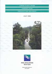
Book, Lower Plenty River concept plan: prescription document, 1992_07
Draft concept plan prepared. by Brett Cheatley, Malcolm Warren and Ian Womersley, Parks and Waterways Planning Division, Melbourne Water. Includes management areas and key strategies for the Lower Plenty River.Book, mainly black and white print, colour photographs and plans, 66 pages. 3 copiesplenty river, melbourne water, lower plenty river -
 Greensborough Historical Society
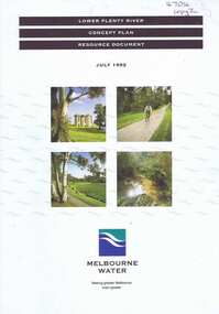
Book, Lower Plenty River concept plan: resource document, 1992_07
Draft concept plan prepared by Brett Cheatley, Malcolm Warren and Ian Womersley, Parks and Waterways Planning Division, Melbourne Water. This document includes information on the heritage and environment of the Lower Plenty River.Book, mainly black and white, colour photographs and plans, 56 pages, 3 copies.plenty river, melbourne water, lower plenty river -
Ringwood and District Historical Society
Pamphlets, Maroondah / Ringwood: Various leaflets about local organisations and events, primarily Arts related. 2004-2008, 2004 - 2008
Various leaflets about local organisations and enterprises:; 1. Summer series 2007-2008;; 2. 2004 Maroondah - Winter Arts Festival;; 3. Parks and Paths Maroondah;; 4. Waterways of Maroondah;; 5. Maroondah Movement for Reconciliation Inc 2008; 6. Maroondah Art Gallert Program 2007; 7. Disabled Persons Craft and Display Fair 1981. -
 Eltham District Historical Society Inc
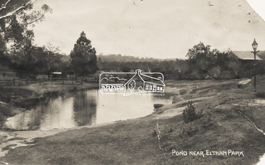
Photograph - Photo Postcard, Pond near Eltham Park, c.1910
This card depicts the pond near Eltham Park (later Eltham Lower Park) circa 1910. The view is taken from Maria Street (Main Road) opposite Dalton Street looking northwest across the Dalton Street road extension reserve (now Wingrove Park Trail) and Jarrold farm. A haystack is visible. Also visible is a gas streetlight and White Cloud cottage which belonged to the Jarrold family From the same collection as accession no. 00778, (Yarra at Eltham) - sent from Eltham and addressed to "Mr J. L. Brown, "Elthamville", Tinning Street, Brunswick" "with love from Nellie" who was most probably a member of the extended Brown family, and no. 00780 (Eltham, J.H. Clark Photo - dated 20 May 1911). Sending postcards to family and friends including short messages was a common form of communication in the early 20th century. Part of a slide show presentation "Bridges & Waterways of the Shire" by Russell Yeoman to the 13 September 1989 Society meeting. The presentation included slides of historic photos from the Shire of Eltham Pioneers collections as well as several recent views.Sending postcards to family and friends including short messages was a common form of communication in the early 20th century.Sepia postcard in very poor condition which has been removed from an album. Glue residue and album page adhering preventing information being readFront: Pond near Eltham Parkpostcard, eltham, pond, dalton street, duck pond, eltham park, elthamville, gas lamp, haystack, jarrold cottage, jarrold property, main road, maria street, white cloud cottage, wingrove park trail -
 Eltham District Historical Society Inc
Book, D. Pendavingh, Yarra River Trail Plan 1989: Banksia Street to Warrandyte, 1989
... Waterways & Parks Division Board of Works ...Also contains a loose A3 mylar plan inserted - Depart of Planning and Urban Growth, Heidelberg; Main Yarra Trail; Warringal Parklands and Banyule Flats, Detail Plan and Locality Plan -
 Eltham District Historical Society Inc
Slide - Photograph, Footbridge, Montmorency Park, c.Sep. 1989
Part of a slide show presentation "Bridges & Waterways of the Shire" by Russell Yeoman to the 13 September 1989 Society meeting. The presentation included slides of historic photos from the Shire of Eltham Pioneers collections as well as several recent views.35mm colour positive transparency (1 of 15) Mount - Agfa CS System grey 8 dotsfootbridge, montmorency park -
 Eltham District Historical Society Inc
Film - Video (VHS), Nillumbik Shire Council, The Nillumbik Story, 1996
PART 1 – NILLUMBIK (00:00-07:17) Opening features various scenes around Nillumbik Shire. For 40,000 years Nillumbik was the home of the Wurundjeri people. Robert Hoddle gave the district its name. Jock Ryan, then president of Nillumbik Historical Society discusses the names Nillumbik and Diamond Creek. In the late 1830s white occupation began with gold found in Warrandyte in 1851 and 12 years later at Diamond Creek -the Diamond Reef which led to the Caledonian gold rush. Jock Ryan discusses the Diamond Creek mine, which was thriving until it burnt out in 1915. Large numbers of workmen moved into area in late 1870s to construct the Maroondah Aqueduct. With growing population of Melbourne, the nearby Yan Yean system had severely disrupted the flow of the Plenty River, forcing the closure of three flour mills there. The aqueduct came to the rescue carrying water 66km from Healesville to Preston. When the Diamond Creek gold mine burnt down the local economy suffered but fruit growing industry had already been established and Diamond Creek became a thriving fruit growing centre. Interview with Jack Powell, a long-time fruiterer at St Andrews market, his family had lived in the area for a hundred years, 3 to 4 generations, “a lot of hard work”. By the time the railway arrived fruit growing was no longer competitive. The railway brought the city closer and day trippers. The Green Wedge separates the shire from the more densely developed neighbours such as Whittlesea, Doncaster, Templestowe, Bulleen and Greensborough. Population at the time (1996) was 19,000 but links to the past remain strong. Mudbrick houses along the Heritage Trail The saving of Shillinglaw Cottage from demolition in 1963 and relocation brick by brick. PART 2 – ENVIRONMENT (07:18-14:44) Peter Brock (with Bev Brock in background) at St Andrews market discusses his childhood growing up in the district and the environment and the values it instilled upon him and his own family. The Brocks have been in the district since the 1860s. Nillumbik Shire responsible for managing three catchment areas; Diamond Creek, Arthurs Creek and Watsons Creek. Follows the course of the Diamond Creek commencing in Kinglake through the district to its confluence with the Yarra River at Eltham at Eltham Lower Park. Highlights Eltham Lower Park community revegetation program and the newly constructed (1996) viewing platform built of new and recycled timbers at the confluence of the Diamond Creek and Yarra River. Also featured are outdoor recreation on the river and at Eltham Lower Park including the Diamond Valley miniature railway. Sugarloaf reservoir and recreational activities and fishing. Aerial view of Memorial Park and Shire of Eltham War Memorial tower at Garden Hill, Kangaroo Ground. Significant tourism opportunities for the shire with 3 million potential day-trippers in metropolitan Melbourne. Council and community working together to find a way to promote the shires natural and artistic assets. At Arthurs Creek, the Brock family and neighbours working together to take care of their waterway. Peter Brock’s uncle, Sandy Brock talks about environmental management and the Arthurs Creek Landcare group and actions to eradicate blackberry problem. Having previously planted Cypress rows they are replacing them with indigenous species to improve the water supply, keeping cattle out of the creek bed to improve the quality downstream flowing into the Yarra. Eltham East Primary School Band playing “All things bright and beautiful” merges into scenes of the bushland sanctuary set aside by the school in 1980 with unidentified teacher discusses the sanctuary and their education program and school children’s comments. Plight of a family of Wedgetail eagles nesting in the path of a developer’s bulldozer at North Warrandyte and actions to save their nesting areas. PART 3 – ARTS (14:45-22:00) Arts and Jazz festival at Montsalvat featuring interviews with Sigmund Jorgensen discussing Montsalvat and its principles. Also Matcham Skipper. Clifton Pugh’s funeral at Montsalvat and his legacy at Dunmoochin near Cottlesbridge with artists in residence, at the time, Chicago artist Charles Reddington who discusses the benefits of the experience. An unidentified female artist also talks about the program and why people are drawn to the area. Unidentified man on street talking about the amount of talent in the area, artists, poets, musicians, authors. Artist Ming Mackay (1918-2009) interviewed talking about the people she mixes with on “the Hill”. Works of local artists are displayed Eltham Library Community Gallery and Wiregrass gallery with a new coffee shop at the Wiregrass making it an even more popular destination. Music at St Andrews Hotel (may be a little bit country) and the Saturday market where likely to hear anything. Sellers and patrons at the market asked about what attracts them to the market and where they came from. Scenes of poets/authors giving readings. CREDITS Music by John Greenfield from the CD Sweet Rain “The Snow Tree”, Uncle Music UNC 2001 Cameras - David Mirabella and Peter Farragher Editor – Olwyn Jones Written and Produced by Jason Cameron A Jason Cameron Proction for Nillumbik ShireProvides a record of the relatively newly created Shire of Nillumbik at the time and the features and attactions of the shire in its people arts, culture and environmentVHS Cassette (two copies) Converted to MP4 file format 0:22:00, 1.60GBvideo recording, arthurs creek, arthurs creek landcare group, artists, artists in residence, arts, arts festival, authors, blackberry, brock family, bulldozer, bulleen, bushland sanctuary, caledonian gold rush, charles reddington, clifton pugh, cottlesbridge, cypress rows, developer, diamond creek, diamond creek mine, diamond reef, diamond valley miniature railway, doncaster, dunmoochin, education program, eeps, eltham, eltham east primary school, eltham east primary school band, eltham library community gallery, eltham lower park, environment, fishing, flour mill, fruit growing, fruiterer, garden hill, gold mining, green wedge, greensborough, heritage trail, hurstbridge railway line, jazz festival, jock ryan, kangaroo ground, kangaroo ground tower, kinglake, maroondah aqueduct, matcham skipper, memorial park, ming mackay (1918-2009), montsalvat, mudbrick houses, music, musicians, nesting area, nillumbik historical society, nillumbik shire, north warrandyte, old timer, orchards, peter brock, plenty river, poets, population, recreation, recreational activities, revegetation, robert hoddle, sandy brock, shillinglaw cottage, shire of eltham war memorial, sigmund jorgensen, st andrews hotel, st andrews market, sugarloaf reservoir, templestowe, the hill, tourism, viewing platform, warrandyte, water catchment area, watsons creek, wedgetail eagle, whittlesea, wiregrass gallery, wurundjeri, yarra river, jack powell -
 Bayside Gallery - Bayside City Council Art & Heritage Collection
Map - print, Melbourne and Metropolitan Board of Works, Interim development order: Brighton, Moorabbin and Sandringham, 1959
The Melbourne and Metropolitan Board of Works (now Melbourne Water) was established in 1891. From that time, as part of their work laying water and sewerage connections, they created detailed plans of houses and other buildings in the Melbourne metropolitan area. In 1956 it acquired powers to construct and maintain highways and bridges, protect and improve the foreshores and create and maintain parks within the metropolitan region. This Interim development order comprises part of the municipalities of Brighton, Moorabbin and Sandringham and was made on 20 October 1959.brighton, moorabbin, sandringham, melbourne and metropolitan board of works, map, town planning, cartographic material, interim development order, bayside